🚚 Free Worldwide Shipping on All Orders!Shop Now
OS Explorer Map OL28 - Dartmoor
This OS Explorer OL28 Map covers Dartmoor National Park including Princetown, Buckfastleigh, The River Plym, and The Tarka Trail. Dartmoor National Park is the largest area of open country in southern England and is famous for its wooded gorges, tumbling rivers and open moorland.
The scale of this OL 28 Explorer map is 1:25,000 where 4cm equals 1km, or 2.5 inches equals 1 mile.
With this map you will receive a code for a free mobile download onto your smartphone or tablet (iOS or Android).
The scale of this OL 28 Explorer map is 1:25,000 where 4cm equals 1km, or 2.5 inches equals 1 mile.
With this map you will receive a code for a free mobile download onto your smartphone or tablet (iOS or Android).
Select Map Finish
From $5.21
Original: $17.36
-70%OS Explorer Map OL28 - Dartmoor—
$17.36
$5.21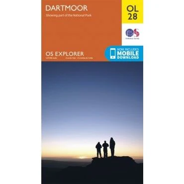
Description
This OS Explorer OL28 Map covers Dartmoor National Park including Princetown, Buckfastleigh, The River Plym, and The Tarka Trail. Dartmoor National Park is the largest area of open country in southern England and is famous for its wooded gorges, tumbling rivers and open moorland.
The scale of this OL 28 Explorer map is 1:25,000 where 4cm equals 1km, or 2.5 inches equals 1 mile.
With this map you will receive a code for a free mobile download onto your smartphone or tablet (iOS or Android).
The scale of this OL 28 Explorer map is 1:25,000 where 4cm equals 1km, or 2.5 inches equals 1 mile.
With this map you will receive a code for a free mobile download onto your smartphone or tablet (iOS or Android).