🚚 Free Worldwide Shipping on All Orders!Shop Now
Lošinj Island Walking Map [21]
This Lošinj Island walking map describes the walking paths and trails on the Adriatic island of Lošinj at a scale of 1:25,000. There are over 250km of walking and cycling paths on Lošinj Island, with it’s highest peak being Osoršćica at 589m high.
Highlighted on the map are numerous walking, hiking and cycling routes, complete with brief descriptions. As well as Lošinj Island, the map also covers the islands of Unije, Ilovik, and Susak.
Published by SMAND (map number 21), the map legend/key is in Croatian, German, Italian, and English text.
Highlighted on the map are numerous walking, hiking and cycling routes, complete with brief descriptions. As well as Lošinj Island, the map also covers the islands of Unije, Ilovik, and Susak.
Published by SMAND (map number 21), the map legend/key is in Croatian, German, Italian, and English text.
$4.79
Original: $15.97
-70%Lošinj Island Walking Map [21]—
$15.97
$4.79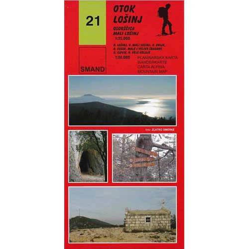
Description
This Lošinj Island walking map describes the walking paths and trails on the Adriatic island of Lošinj at a scale of 1:25,000. There are over 250km of walking and cycling paths on Lošinj Island, with it’s highest peak being Osoršćica at 589m high.
Highlighted on the map are numerous walking, hiking and cycling routes, complete with brief descriptions. As well as Lošinj Island, the map also covers the islands of Unije, Ilovik, and Susak.
Published by SMAND (map number 21), the map legend/key is in Croatian, German, Italian, and English text.
Highlighted on the map are numerous walking, hiking and cycling routes, complete with brief descriptions. As well as Lošinj Island, the map also covers the islands of Unije, Ilovik, and Susak.
Published by SMAND (map number 21), the map legend/key is in Croatian, German, Italian, and English text.