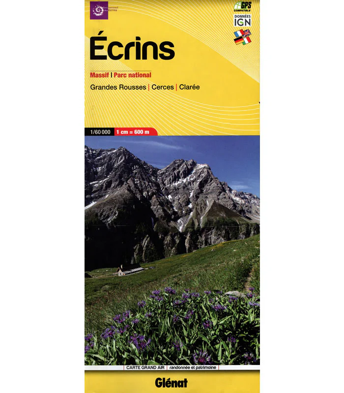
Ecrins National Park Walking Map
This Ecrins National Park Walking Map, covers the Ercins Massif, Grandes Rousses, Cerces, and Claree at a scale of 1:60,000, and is ideal for for hikers and walkers.
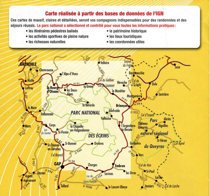
The Écrins massif includes 150 peaks over 3000m and approximately 10,000 hectares of glaciers. The Écrins National Park is the largest national park in France and includes the famous peaks of Barre des Écrins (4,102m high), and Mont Pelvoux (3,946 m high).
This map includes the towns/villages of: l'Alpe-d'Huez, la Bourg-d'oisans, les Deux-Alpes, St-Bonnet-en-Campsaur, Saint-Michel-de-Chaillol, Ancelle, Gap, Savines-le-Lac, Embrun, Station-de-Orres, Station de Risoul 1850, Risoul, Guilestre, Orcieres-Merlette, l'Argentiere-la-Bessée, Vallouise, Briançon, Chantemerle, Villeneuve, le Monetier-les-Bains, Névache, and Bardonecchia.
Scale is 1:60,000.
ISBN is 9782344065129.
Description
This Ecrins National Park Walking Map, covers the Ercins Massif, Grandes Rousses, Cerces, and Claree at a scale of 1:60,000, and is ideal for for hikers and walkers.
The Écrins massif includes 150 peaks over 3000m and approximately 10,000 hectares of glaciers. The Écrins National Park is the largest national park in France and includes the famous peaks of Barre des Écrins (4,102m high), and Mont Pelvoux (3,946 m high).
This map includes the towns/villages of: l'Alpe-d'Huez, la Bourg-d'oisans, les Deux-Alpes, St-Bonnet-en-Campsaur, Saint-Michel-de-Chaillol, Ancelle, Gap, Savines-le-Lac, Embrun, Station-de-Orres, Station de Risoul 1850, Risoul, Guilestre, Orcieres-Merlette, l'Argentiere-la-Bessée, Vallouise, Briançon, Chantemerle, Villeneuve, le Monetier-les-Bains, Névache, and Bardonecchia.
Scale is 1:60,000.
ISBN is 9782344065129.


