🚚 Free Worldwide Shipping on All Orders!Shop Now
Cagliari and Gulf of Cagliari walking map [1]
This Cagliari e il suo golfo walking map covers many walking, hiking and cycling paths and trails around Cagliari and the Gulf of Cagliari (also known as the Gulf of the Angels), at a scale of 1:60,000. The map covers the western half of the Sarrabus Mountains, including its highest peak of Punta Serpeddi at 1,069m high.
The whole map is in English and Italian text including detailed descriptions of the various archaeological sites, churches, monuments, museums and beaches that are shown on this map of Cagliari, plus it describes a number of graded walking and cycling routes.
Published by Edizioni Abies this is map number 1 out of a series of 12 maps that cover the whole coast of Sardinia. The map legend/key is in Italian, German, French, and English text.
$4.39
Original: $14.63
-70%Cagliari and Gulf of Cagliari walking map [1]—
$14.63
$4.39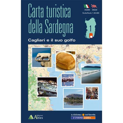
Description
This Cagliari e il suo golfo walking map covers many walking, hiking and cycling paths and trails around Cagliari and the Gulf of Cagliari (also known as the Gulf of the Angels), at a scale of 1:60,000. The map covers the western half of the Sarrabus Mountains, including its highest peak of Punta Serpeddi at 1,069m high.
The whole map is in English and Italian text including detailed descriptions of the various archaeological sites, churches, monuments, museums and beaches that are shown on this map of Cagliari, plus it describes a number of graded walking and cycling routes.
Published by Edizioni Abies this is map number 1 out of a series of 12 maps that cover the whole coast of Sardinia. The map legend/key is in Italian, German, French, and English text.
The whole map is in English and Italian text including detailed descriptions of the various archaeological sites, churches, monuments, museums and beaches that are shown on this map of Cagliari, plus it describes a number of graded walking and cycling routes.
Published by Edizioni Abies this is map number 1 out of a series of 12 maps that cover the whole coast of Sardinia. The map legend/key is in Italian, German, French, and English text.


