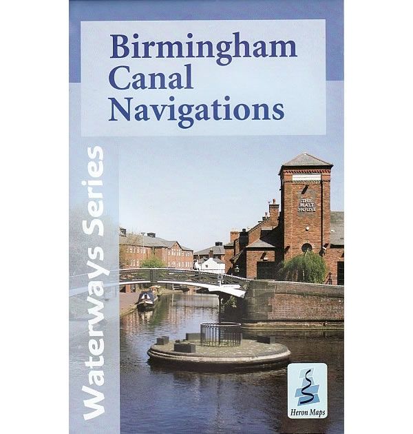
Birmingham Canal Navigations Heron Map
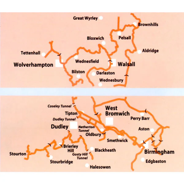
This Heron waterways map covers Birmingham Canal Navigations, a series of canals that meet at Birmingham, totalling around 100 miles that is reputedly, more than Venice. The map provides detailed information for both waterways and leisure users, and it is complimented by information panels and photographs.
The Birmingham Canal Navigations helped to power the Industrial Revolution in Birmingham, bringing coal and raw materials into the city and transporting finished goods to other parts of the country and the ports for shipment to the rest of the world.
Gas Street Basin in the city centre was once the hub of the network, whilst the working boats may have disappeared itís still bustling, only now with pleasure craft. The basin is a mixture of both old and new, restored canal buildings, vibrant restaurants, bars and cafÈs, entertainment venues like the International Convention Centre, National Indoor Arena and theatres, as well as just being minutes from shopping centres and New Street Station.
Other attractions and industrial marvels on the network include the Black Country Living Museum, Red House Glass Cone, the Dudley and Netherton Tunnels, Stourbridge Locks and conservation area, Wolverhampton Locks and Farmerís Bridge Locks.
Despite much of the Birmingham Canal Navigations being urban, there are quieter waters to be found meandering through more suburban and rural areas such as the lock free Wyrley and Essington Canal.
This cruising and tourist map of the Birmingham Canal Navigations is at an extra-large scale of 1:30,000, with a detailed town plan of Central Birmingham at a scale of 1:10,000.
The map includes navigation and historical information, visitor moorings, marinas and boatyards, boat hire centres, facilities for the boat user, shops, post offices and distance markers. Information for the tourist includes tourist information centres, places of interest, pubs, nature reserves, parks, churches, long distance paths, public toilets, plus caravan and camp sites.
Published by Heron Maps in 2012.
Scale is 1:30,000.
ISBN is 9781908851017.
The Birmingham Greenways map describes 150 miles of traffic free walking and cycling paths around Birmingham, the Black Country and Solihull. It features traffic free paths along canals, rivers, and parks in Birmingham, and is a great addition with this Birmingham Canal Navigations Waterways Map.
Description
This Heron waterways map covers Birmingham Canal Navigations, a series of canals that meet at Birmingham, totalling around 100 miles that is reputedly, more than Venice. The map provides detailed information for both waterways and leisure users, and it is complimented by information panels and photographs.
The Birmingham Canal Navigations helped to power the Industrial Revolution in Birmingham, bringing coal and raw materials into the city and transporting finished goods to other parts of the country and the ports for shipment to the rest of the world.
Gas Street Basin in the city centre was once the hub of the network, whilst the working boats may have disappeared itís still bustling, only now with pleasure craft. The basin is a mixture of both old and new, restored canal buildings, vibrant restaurants, bars and cafÈs, entertainment venues like the International Convention Centre, National Indoor Arena and theatres, as well as just being minutes from shopping centres and New Street Station.
Other attractions and industrial marvels on the network include the Black Country Living Museum, Red House Glass Cone, the Dudley and Netherton Tunnels, Stourbridge Locks and conservation area, Wolverhampton Locks and Farmerís Bridge Locks.
Despite much of the Birmingham Canal Navigations being urban, there are quieter waters to be found meandering through more suburban and rural areas such as the lock free Wyrley and Essington Canal.
This cruising and tourist map of the Birmingham Canal Navigations is at an extra-large scale of 1:30,000, with a detailed town plan of Central Birmingham at a scale of 1:10,000.
The map includes navigation and historical information, visitor moorings, marinas and boatyards, boat hire centres, facilities for the boat user, shops, post offices and distance markers. Information for the tourist includes tourist information centres, places of interest, pubs, nature reserves, parks, churches, long distance paths, public toilets, plus caravan and camp sites.
Published by Heron Maps in 2012.
Scale is 1:30,000.
ISBN is 9781908851017.
The Birmingham Greenways map describes 150 miles of traffic free walking and cycling paths around Birmingham, the Black Country and Solihull. It features traffic free paths along canals, rivers, and parks in Birmingham, and is a great addition with this Birmingham Canal Navigations Waterways Map.


